Death By Ring Road: Looking for Life Beyond Leeds Street
Vauxhall is 'Pumpfields' these days, apparently, site of multiple failed apartment developments. But this area has an rich, deep local history that deserves respect.
The words we use to describe the places that surround us have more power and resonance than, perhaps, we realise.
Let’s say they demolished the Liver Building tomorrow. Razed it to the ground, levelled it off and left the area for dead. For a while it we’d wistfully refer to it as the old Liver Building site. Grass might recolonise it and it might well become Liver Building Fields. But if it was left long enough, with no development reclaiming its corner of the city, chances are it would become just another brownfield site.
Is there a more depressing phrase in the developer’s dictionary? It’s a short hand for a nowhere land, a ‘nothing to see here, and never has been’ sleight of hand, used to encourage developers to pile in and have their way with their CGI renders and fractional sales models marketed to hapless investors, with little regard to the area’s history. Because there is no history in a brownfield site. Right?
I’m thinking of this when I read of the stuttering, undignified and depressing litany of failed dreams and schemes in the Pumpfields area, around Bevington Bush and Vauxhall Road, kept apart from the city by the Leeds Street ring road.
This was (and still is, I guess) a heralded Mayoral Development Area. You can still read about the previous Mayor’s big ideas here. It talks of how the area has lots of “developments in the pipeline”. Someone had better call out Dynorod, if that’s still the case. It calls for “new areas of public realm and enhanced landscaping” - er, that might be the wilting shrubbery at the Mercedes Benz showroom. Most importantly, it trumpets “the diversification of land uses... to establishes a vision for the future... supported by a series of development principles which will ensure that future developments will be well integrated and contribute to realising this vision”. It’s all there, in the glossy Regenerating Liverpool framework. Paid for by us, written by people we voted into power.
So it must be true, right?
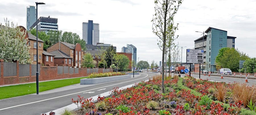
You’d think that the Pumpfields site was perfectly located for a healthy future, as it’s just minutes away from the buzz of the city and the once World Heritage Listed waterfront. But our city centre isn’t like the others. We built a huge dual carriageway, above, just 500 metres away from the steps of our Town Hall, signifying the perimeter of our aspirations.
It also slammed the brakes on any hope of a city centre that blends harmoniously into healthy neighbourhoods and bustling suburbs. We might as well have dug a moat.
Leeds Street acts like some invisible force field, cutting off the once-vibrant Vauxhall community from any hope of salvation. A ring road so chokingly close to the heart of the city it could only ever act like a tourniquet. Yet despite this Councillor Malcolm Kennedy proclaimed that it was a great idea to actually extend it. “It’s a critical piece in our masterplan to unlock the vast potential of North Liverpool,” he said. Well, he’d know. He must get a great view of his North Liverpool constituency from his Spanish home, 1,300 miles away.
Does more road equal more regeneration? Or is that model well-and-truly broken? Does a 40-metre-wide gash of asphalt crammed with traffic all day long bring us closer together? Bring better connectivity? Or does it make it impossible for the city to have any hope of turning its hinterlands into viable arrondissements?
We’ve only to look at Vauxhall’s recent history, and compare it to the Baltic’s bounce back to make an educated guess.
The Reach on Leeds Street looked tired and forlorn within years of completion. Surely this only ever got built because it was considered beyond the pale? Outside the city walls? But it did, at least, manage to get constructed.
That’s more than can be said for North Point, the £90 million Pall Mall development that came crashing down, only to be bought by the Elliot Group - and we all know how well that particular story’s going.
Then there was talk of Bevington Bush Village - a fortress of student flats (we can’t even be bothered putting a picture in here - you know exactly what they’d look like), later morphed into apartments, with retail, shops and a gym - which won planning permission five years ago, and went nowhere. The vivid yellow ‘keep out’ hoardings have lasted longer than the scheme.
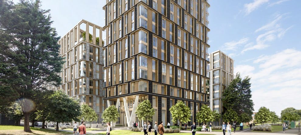
Later still, with swish artists’ impressions of a ‘vibrant community’ with rooftop fire pits and hammocks courtesy of architects Falconer Chester Hall, came The Tannery (above): a swanky new cluster of apartments with views across to the river. Wonder if FCH visited the Eldonian village? They’ve miraculously created a vibrant community without a single fire pit or rooftop cocktail party. I’m guessing not.
They marketed the Tannery ‘the brownfield boutique’ - because that’s all the developers considered ancient Vauxhall to be. Brownfield in search of a boutique.
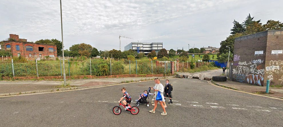
Mind you, their prophecy came true. Because the site is now a fly-tipping hinterland of discarded sofas, rubble and surface car parks. The property company behind the scheme has called in the liquidators a few months ago, leaving investors millions of pounds out of pocket.
And who remembers The Metal Works - yet another me-too scheme that’s so far screwed investors out of their life savings. The developers, Pumpfield Regeneration Company has an outstanding debt to Liverpool City Council of nearly a million quid, according to this excellent piece in the Scottie Press.
Currently, the Bevington Bush site is on the market. Should you have £6million knocking around, it can be yours. The city doesn’t want it. Once they’ve written their regeneration wish list, they can wash their hands of the whole sorry business.
It’s easy to see this slice of the city as a lost cause and, at the same time, kind of shrug and move on. It’s a brownfield site. Nothing lost, nothing gained.
But, here specifically, we’d be wrong. Because this tiny corner of the city has a history that’s rich, deep and more culturally significant than any student castle or loft-living penthouse could ever be. It’s not market failure that’s got us here - it’s a failure of our own making.
The litany of dubious property development companies attracted to our city is as shameful as it is preventable - the language of the city’s own Regeneration Framework still encourages the practice, and continues to grant planning permission for scheme after failed scheme - with Vauxhall’s Pumpfields ground zero.
Isn’t the definition of madness doing the same thing over and over and expecting a different outcome?
When we started SevenStreets, our aim was to look a little deeper at these in-between places, to see what we’d been missing. What the language we use about our home city was actually mis-telling us. And when we explored Bevington Bush we were amazed at what we unearthed.
SevenStreets has been rumbled. Caught in the act, tripod fully extended, a man approaches us.
“What are you doing lad?”
“Just taking some pictures,” we explain.
A thin rain has begun to fall on the two of us, as we hover at the edge of our personal zones.
“There’s nothing here. What you photographing? A brick wall?” our passing inquisitor remarks.
It’s true. We are. We’re standing on a crumbling kerb leading to twenty metre-long road so seemingly insignificant even Google Maps have got it wrong. For most of its virtual route, the Google site has it incorrectly attributed, adding a full two-thirds to its length.
Back in the real world, the road is no more than a tarmac comma, biting into a fly-tipped verge. And look at us, snapping away as if we’d cornered Jürgen Klopp in Greggs.
“There used to be something here,” we say.
“Ah well, there’s not now” he says, unarguably and finally. Then - seemingly struck by a more pressing concern - he shuffles off in the direction of the city.
We’re at Bevington Bush - not, alas, a private detective under the employ of Bertie Wooster, but one of the most curious corners of our city’s map.
Bevington Bush curls in the crook between Scotland Road and Leeds Street. Just to the north, the Kingsway approach dives under the patchwork of so-called brownfield sites just to the north of the city centre.
In the middle of the 18th century the fields around here were gold and green. Bevington Bush was a hamlet hunkered within a thickly wooded hill. The ‘bush’, was a patch of elevated land on which a profitable crop of corn grew.
Two centuries ago Bevington Bush was a pastoral idyll. City merchants used to enjoy nothing better, on a Sunday afternoon, than to stroll from the industry of town to the open fields of Bevington Bush - the first village on the road to Preston.
They chose their route well. For Bevington Bush was home to a popular inn, perfectly placed for that reviving Sunday afternoon session.
In his book Liverpool: Our City - Our Heritage, (Bluecoat Press) historian Freddie O’Connor reveals that “…In 1760, half a mile from St Patrick’s Cross (in what’s now Great Crosshall Street) along Bevington Bush Road was an inn called The Bush, which became a favourite haunt for folk to travel out into the country, to the Bevy Inn, as it became fondly known.”
“The sailors were very fond of going to the Bevington Bush Inn, or The Bevvy, with their sweethearts. The view was really beautiful. Along the Scotland Road were cornfields, meadows and gardens”.
The gardens didn’t last long. With the opening of Scotland Road the ancient hamlet of Bevington Bush soon became surrounded by our ever-growing city. But the inn remained - even adding its own brewery, Hallsal Seager and Co, in 1834. By the turn of the 20th century, the street musician Seth Davy entertained the drinkers: and was the inspiration behind the folk classic, Whiskey on a Sunday.
In time, Scotland Road’s manor houses and market gardens made way for a mass of cramped houses, most of them back-to-back. Many of Liverpool’s notorious tiny courts were to be found here, with families living close to the “thick smoke and foul vapours. Houses and courts squeezed in amongst industrial premises”.
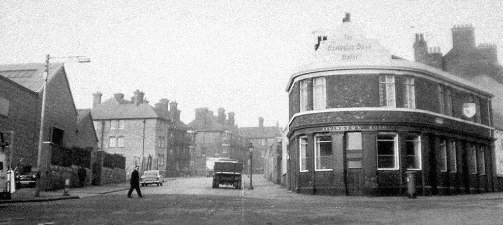
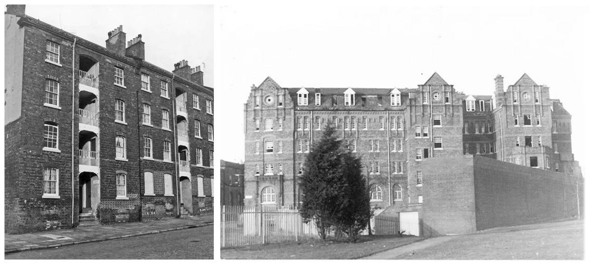
Liverpool Corporation built St Martin’s Cottages in 1869, the first council houses in Europe, at Bevington Bush (above left). The impressive Bevington Bush Baths were the largest municipal swimming baths in the country.
Enlightened family housing wasn’t the answer for the transient population of labourers and dockers, who also needed a safe place to lay their head. By the end of the 19th century, up to 14,000 workers needed lodgings - many of whom saw sanctuary in the Bevington Bush Hotel, opened in 1900, offering 500 rooms for a penny a night. As long as you were sober.
The hotel became Arden House (above right), and, eventually the city’s first Salvation Army refuge. It was demolished in 1986.
Since then the area’s been pruned, pinched and penned into its present state - a slither of a street, fought over by come-day go-day developers.
A corn field, a country village, an inn, a brewery, an experimental social housing scheme, rambling hotel busy market.
That’s a TLDR version of saying, yes, this is a brownfield site. Makes you wonder - what if a resident from the 19th century came back to take a look around the old place now - full of hoardings from defunct developers and barely-occupied building sites? What’s the betting they’d ask: so this is progress?




Beautiful as well as heartbreaking. My own barometer of desperation, if that’s a thing, around here is Eldon Grove. “Like a third cathedral” I’ll often say and sometimes write. As yet another last chance developer leaves nothing behind them but a bit less roof for the rain to fall through.
Thanks so much. My mother and father were both born in the area (in 1897 and 1903). Dad's father was an Irish immigrant there. My first job after school (1963) was on Tithebarn Street. When I wasn't at Cavern lunchtime sessions I was exploring those streets. I still take visitors round the area (once upon a time that meant a decent pub crawl) to show them what excrement (sorry, development) has wiped out my history.